

How does technology demand a quantitatively driven representation of the earth? How has the increased capacity for technology to store and process data transformed the earth and our ideas about it? What destiny does so-called “Big Data” hold for the myriad crises of the earth?
In Fall 2015, Social Science Matrix is sponsoring a research seminar that will conduct an “investigation into the relationship between the earth and technology," according to the successful proposal, and will “interrogate the production and representation of the earth through an inquiry into the nature of data."
Organized by Phillip Campanile, a graduate student in the UC Berkeley Department of Geography, the seminar will “critically examine the production of the earth through relations between landscape, infrastructure, and data.” The seminar will consider “networked infrastructural landscapes," including the production, aggregation, and analysis of geospatial data by sensing systems "circumscribing and inscribed into the earth."
“This line of questioning demands that we study the material intersection of earth and technology: namely, infrastructure," the proposal explains. "Infrastructural development utilizes data processing technologies in an effort to transform the earth according to a certain set of dominant values, thus creating a landscape that represents those values in its very appearance.”
The seminar will largely focus on the impact of human-built infrastructure, and the degree to which it shapes people's attitudes around the world around them. “Through both its representational and material power, infrastructure filters the kinds of data available to us, constantly remaking the world in its own image: quantifiable, submissive, knowable,” the proposal explains. “Imaging the earth through diverse representational technologies, including mapping, painting, aerial and space photography, and remote sensing, further reproduces the encoding of landscape by and as infrastructure.”
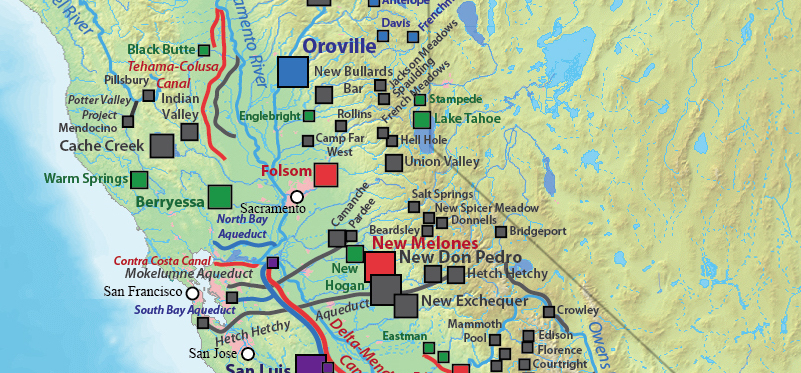
Participants in the seminar will come from fields such as geography, literature, philosophy, cognitive science, landscape architecture, philosophy, intenrational studies, anthropology, and more. As part of their seminar, the group will visit field sites that pertain to Californian hydrologic infrastructure, whose extensive reworking of water channels across the state has fundamentally transformed the State’s landscape in both subtle and dramatic ways. “Given the ongoing drought and the massive tunneling project that aims to divert water to Southern California from the Sacramento River Delta," they write, "we find this issue ideally suited to our concerns regarding landscape, infrastructure, and technology. More broadly, infrastructural systems and artifacts are increasingly the object of highly interdisciplinary academic inquiry and representation, making this seminar especially apposite to our intellectual and political moment.”
Ultimately the seminar seeks to examine the impacts that the GIS and other digital systems are having on our understanding of the world. “We must reconsider the methods by which we measure the earth," the organizers explain. "What kind of fieldwork is up to this task? What kind of creative representational work must we explore in order to think the expanded field of landscape, infrastructure, and data? And how might such representational critique and methodological experimentation help redefine how we go about making social scientific work in the 21st-century university?”